


With 2IN, all the maps you need to act more effectively for your community

What is 2IN?
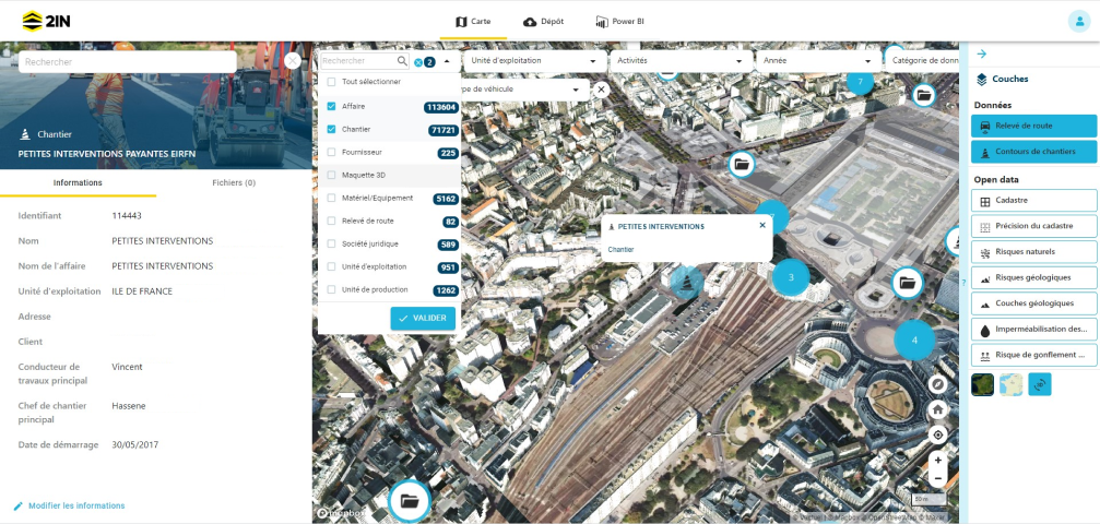
2IN is a mapping platform that streamlines the monitoring of your region and infrastructure, and helps you improve their resilience thanks to enriched data and integrated services.
Watch the demonstrations
The benefits that make the difference
A digital twin
BIM models, Underground networks, IFC, As-built plans, Soil reports, Scatter plots, Images, blueprints, PDF files, and more.Gain a better understanding of your community and your assets thanks to simplified access and use of your data
- Your data visible on a map background
- Accessible to all and with complete control
- A personalized interface based on business needs
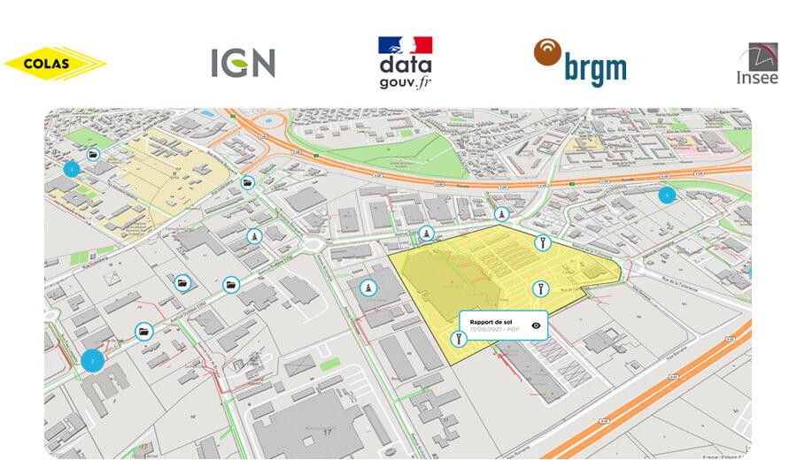
Data
Make more informed decisions by accessing and viewing all the useful data you need in one place
- Default access to data in Open Data
- Integrated access to specialized data
- Your data reintegrated effortlessly
Services
On-demand services allowing you to address your key issues
- Integrated modules and an expert just a click away
- A thorough analysis of the area building
- Technical and financial recommendations


There is no limit for projects. 2IN is a multi-project platform where you can visualize one or more projects directly on the map, and combine their data in one place.
2IN receives and returns a wide variety of data formats: inventory data, BIM digital models, IFC, soil & survey reports, scatter plots, places of interest, etc.
2IN is based on the OpenStreet Map and IGN maps. This allows data to be georeferenced to the nearest centimeter.


